Around the Rock
An island tour...
-
In addition to its wild side, Nfld as many unique cultural & historic attractions. It has been home to some of the oldest native North American and European settlement on the continent.
Hover for larger images and descriptions.
Native Peoples
Beothucks
Shanawdithit
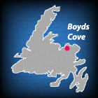
The last of her kind...
This copper statue stands as a reminder of a noble breed of native people who endured life for centuries in primitive isolation before being driven to extinction. Erected on an ancient Beothuck campsite near Boyds Cove NDB
.... at home amongst the trees.
Dorsets
The Dorset Eskimos
Fleur de Lys
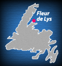
Dorset Soapstone Quarry...
These hollowed impressions were excavated by an ancient tribe of Dorset Eskimos who came from Labrador to mine the site over a period of centuries. The Baie Verte peninsula has produced many mines but this, is the oldest and longest lasting.
Micmacs
Micmac Indians
Conne River
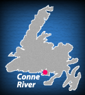
A Traditional Pow Wow...
Staged annually in Conne River the Pow Wow is a colorful display of native culture and character.
Vikings
Lanse aux Meadows
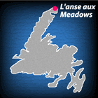
Discoverers of the New World...
Long before Columbus during a period of warmer climate and better ice conditions, these hardy sailors plowed the North Atlantic in open boats establishing the first New World colony in this rugged landscape.
Cultural Icons
Nfld pony
Campbellton
Work horse...
Early settlers brought with them a variety of breeds from western europe. Three centuries of interbreeding led to the emergance of a new breed. Loyal and hard working, they were an essential component of the culture, doing the work of modern day machines. Progress as led to the near demise of this galliant breed.
Stages
Harbour
Round
Fishing premises...
An historic symbol of economic independence in thousands of coastal settlements for centuries. Small boat fishermen caught, landed and processed their daily catch at these private facilities.
Atlantic salmon
Exploits River
(Grand Falls)
Salmo solar...
After years at sea Atlantic salmon migrate from as far away as Greenland to their home rivers overcoming formidable obstacles returning to their place of birth to continue the cycle. Seen here pooling beneath the falls before leaping repeatedly to gain access to spawning beds upstream.
Pitcher Plant
Provincial
Emblem
Sarracenia purpurea...
This carnivorous plant, common in bogs throughout the province captures and devours insects by drowning and dissolving them in pitcher shaped leaves at the base of the stem that capture rainfall.
Light houses
Fort Point
Trinity
Keepers of the light...
Before automation generations of light keepers made an essential contribution to maritime navigation, often risking life and limb to rescue shipwrecked sailors. Many of the lights are still operational, continuing to save wayward vessels from smashing into the jagged shoals along a windswept coastline. Others retired from active use have been converted to tourist resorts affording visitors an authentic encounter with our rich maritime history.
Churches
Wiltondale
In Newfoundland outports where many were lost at sea, the church was a focal point for community healing.
Resettlement
Indian Burying
Place
Testament to a by gone era...
One of the best preserved of the many remote communities abandoned in the 1960s. Residents were forced to move to larger centers to avail of services as part of a government initiative to centralize populations.
Atlantic puffin
Provincial
Bird
Fratercula arctica...
Resembling penguins in appearance these colorful and comical seabirds are much more adept at swimming then flying, often stumbling on take off and landing.
Parks and Reserves
Gros Morne National Park
Western Brook
Pond
Continents in collision...
Throughout the park narrow fjords scoured by glaciers-then dammed at the mouth by rising coastal plains-wind deep into the Long Range Mountains, their steep walls blocking the sun. At Western Brook Pond 600-million-year-old cracks climb skyward, telling of the parting of an ancient continent.
Terra Nova National Park
Malady Head
In Southwest Arm...
the long arms of the sea stretch through the park forming saltwater routes.
West Brook Ecological Reserve
Red Pine
The harvest...
A red squirrel is busy harvesting red pine cones for the coming winter. Rings of fallen cones can be found circling the trunks of selected trees as the cones are harvested and stored. For its part the tree has its seeds dispersed.
King George IV Ecological Reserve
Lloyds River
Delta
Sarracenia purpurea...
This carnivorous plant, common in bogs throughout the province captures and devours insects by drowning and dissolving them in pitcher shaped leaves at the base of the stem that capture rainfall.
Lewis Hills
Serpentine
Valley
The Appalachian Trail
The Newfoundland leg of a network of trails extending through the Appalachian Mountains and into the Long Range.
The River winds through a wide glacial valley cutting through the hills and emptying into the Gulf of St. Lawrence.
The Arches
Northern
Peninsula
Highway
Scenic Lookout
Coastal rock formations consist of dolomitic conglomerates.
Table Point
Northern
Peninsula
Fossiliferous limestone...
460,000,000-year-old Marine fossils embedded in weathered limestone have a sculpted appearance.
Burnt Cape
Northern
Peninsula
Whale Cave
Arctic like conditions produce rare plants at the southernmost tip of their range. Coastal limestone barrens have unique geological features and a harsh microclimate conducive to the plant′s growth.
Coastal Communities
Kings Point
Little Bay Islands
Springdale